Connectivity is Key
Biodiversity, or biological diversity, refers to the variety of living things on earth and can be viewed in terms of variability within species, between species, and between ecosystems. It includes species’ evolutionary histories, genetic variation within and among populations of species, and the distribution of species across habitats, ecosystems, and landscapes. This variety and variation is necessary to sustain the vital services that biologically diverse ecological systems provide.
Habitat loss is the single biggest threat to plant and animal species, both globally and locally. Habitats need to be connected to allow species to breed, feed, and find shelter. When a large habitat is divided by roads, railways, power lines, or human settlements, it gets sliced into smaller patches and may no longer meet species’ needs.
Well-connected habitats that support a wide range of species are important because they act like a natural buffer to the pressures of human activities, extreme weather events, climate change, and invasive species. Highly diverse landscapes can absorb these pressures better, have quicker recovery times, and help support ecosystems and their wildlife.
One of the most recognized approaches to conserving biodiversity focuses on the conservation and protection of large natural areas and the diversity of landscape types within an area. Eastern Georgian Bay is a mosaic of ecosystems ranging from forests and rock barrens to wetlands and rivers. Each of these areas provides important habitat for hundreds of species.
While protecting and conserving large natural areas is important, increased focus is being placed on the importance of bringing together multiple ways of knowing and caring for the land. All along the coast, people are working to address concerns around landscape biodiversity from different perspectives to help create a connected and resilient landscape.
Maamwi Anjiakiziwin
Along the shores of eastern Georgian Bay, Mnidoo-gamii, people are coming together to care for the place they call home. With a focus on species at risk and connecting people and nature, the Maamwi Anjiakiziwin initiative combines the words and meanings of “together,” “land,” “renewal,” and “life.”
The first part of the word, Maamwi talks about working together, and Anji means “renewal.” Aki talks about land but also territory because we want to be sure that we’re encompassing that in all that we’re doing. And the last part talks about life, which reminds us to continue living in a good way.
Sherrill Midwewekamigokwe Judge, Georgian Bay Mnidoo Gamii Biosphere
The Maamwi Anjiakiziwin initiative acknowledges that there is strength and value in partnership. This species at risk conservation project brings together First Nations, not-for-profits, and municipalities to share resources, values, and ideas on how to improve the well-being of species at risk across the landscape in eastern Georgian Bay.
When everyone gets together, there are opportunities to have conversations, share observations, ask questions, create maps, and plan fieldwork programs. In the end, we share an understanding of what the priority conservation work will be, where it will occur, how it will be carried out, and how its effectiveness will be measured.
Greg Mason, Georgian Bay Mnidoo Gamii Biosphere
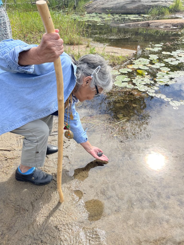
One of the initiative’s key objectives is to engage in cross-cultural learning and intertwine different knowledges. Maamwi Anjiakiziwin includes language and knowledge sharing, ceremonies for the care and release of turtle hatchlings into the wild, and asemma (tobacco) offerings during fieldwork.
Honouring Anishinaabeg worldview and bringing that lens to what we do, braiding and weaving that into everything we do.
Sherrill Judge, Georgian Bay Mnidoo Gamii Biosphere
We’re trying to look after the land. We’re trying to look after the water. We’re trying to look after the communities so that there’s something for our children down the road. In order to help each other, we have to be able to get along, and work together, and have some sort of relationship.
Michele Ten Eyck, Wasauksing First Nation
When we improve our understanding, respect, and relationships with each other, our understanding and relationships with the land will also benefit.
David Bywater, Georgian Bay Mnidoo Gamii Biosphere
Learn more about Maamwi Anjiakiziwin at maamwigeorgianbay.ca.
Road Ecology
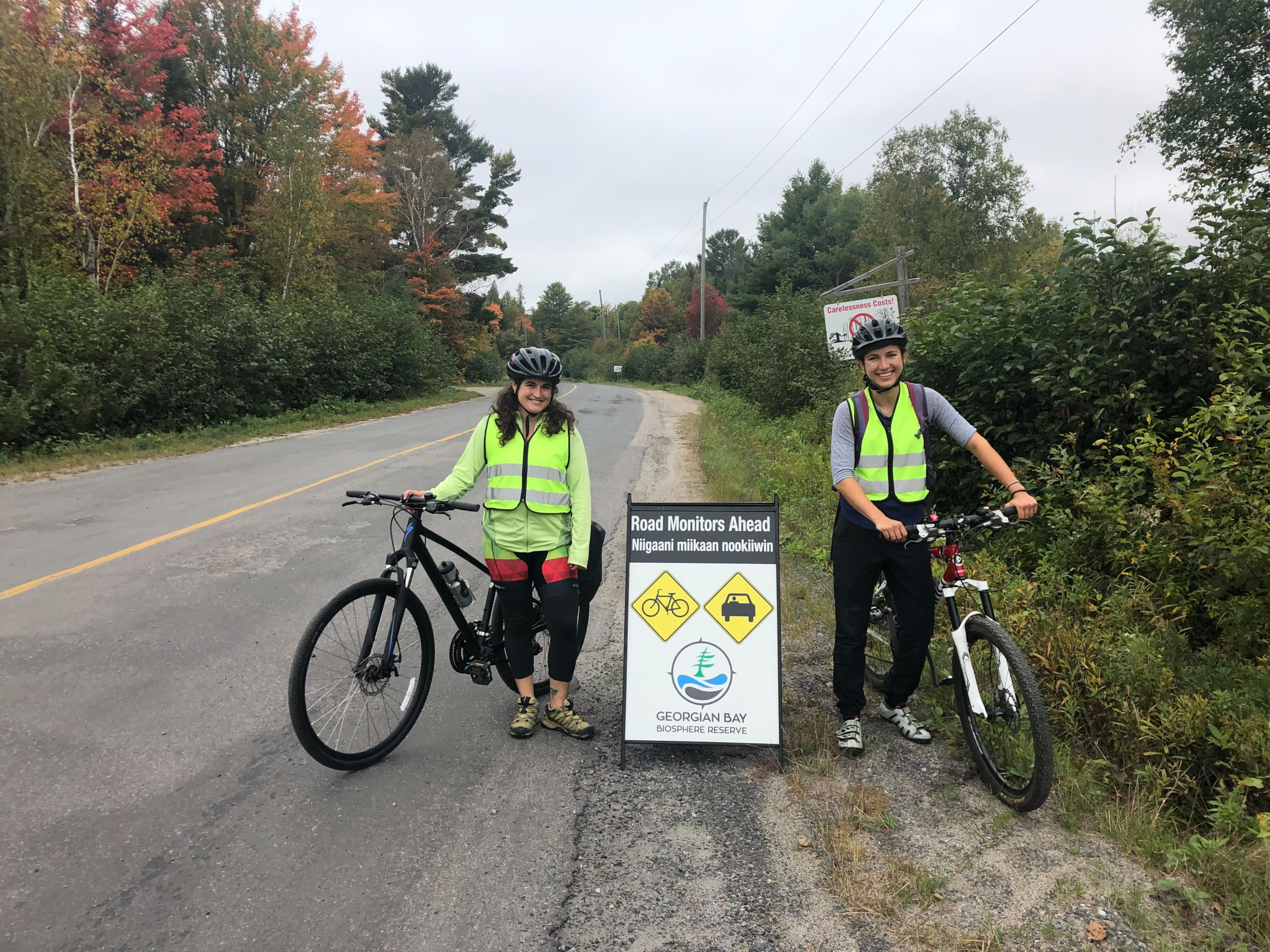
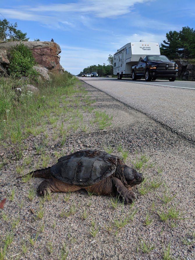
As part of Maamwi Anjiakiziwin, many partners are engaging with multiple ways of knowing to help mitigate threats from roads to at-risk reptiles. Turtles often use roadsides as nesting habitat, increasing the chances of female turtles being hit. As a result, populations alongside roads in some areas have been found to be primarily made up of males. Ongoing mortality of turtles on roads could result in steady population declines due to their life history of delayed maturity, meaning it takes a long time before they can reproduce (up to 20 years for some species).
Snakes use roads for various reasons, including basking on them for thermoregulation. While some snakes attempt to cross roads in order to access habitat, others may avoid roads, thereby preventing their access to important habitat and reducing or altering the population genetics of the area.
Locations where numerous reptiles are found to be crossing or are found dead on roads are called hot spots. For over four years, GBB staff, volunteers, and partners have been biking roads along the coast of eastern Georgian Bay monitoring for at-risk reptiles and identifying hot spots. In this time, they have:
- monitored 12 roads/highways;
- biked over 17,000 kilometres;
- observed over 2,300 reptiles;
- rescued 214 reptiles from the road; and
- identified 42 reptile road mortality hot spots.
Working collaboratively, partners are identifying locations that could benefit from road mortality mitigation and implementing actions, such as turtle incubation programs, invasive species removal, and reptile fencing, to address the impacts roads are having on reptiles. These actions help conserve local biodiversity and restore connections between high-quality habitats.
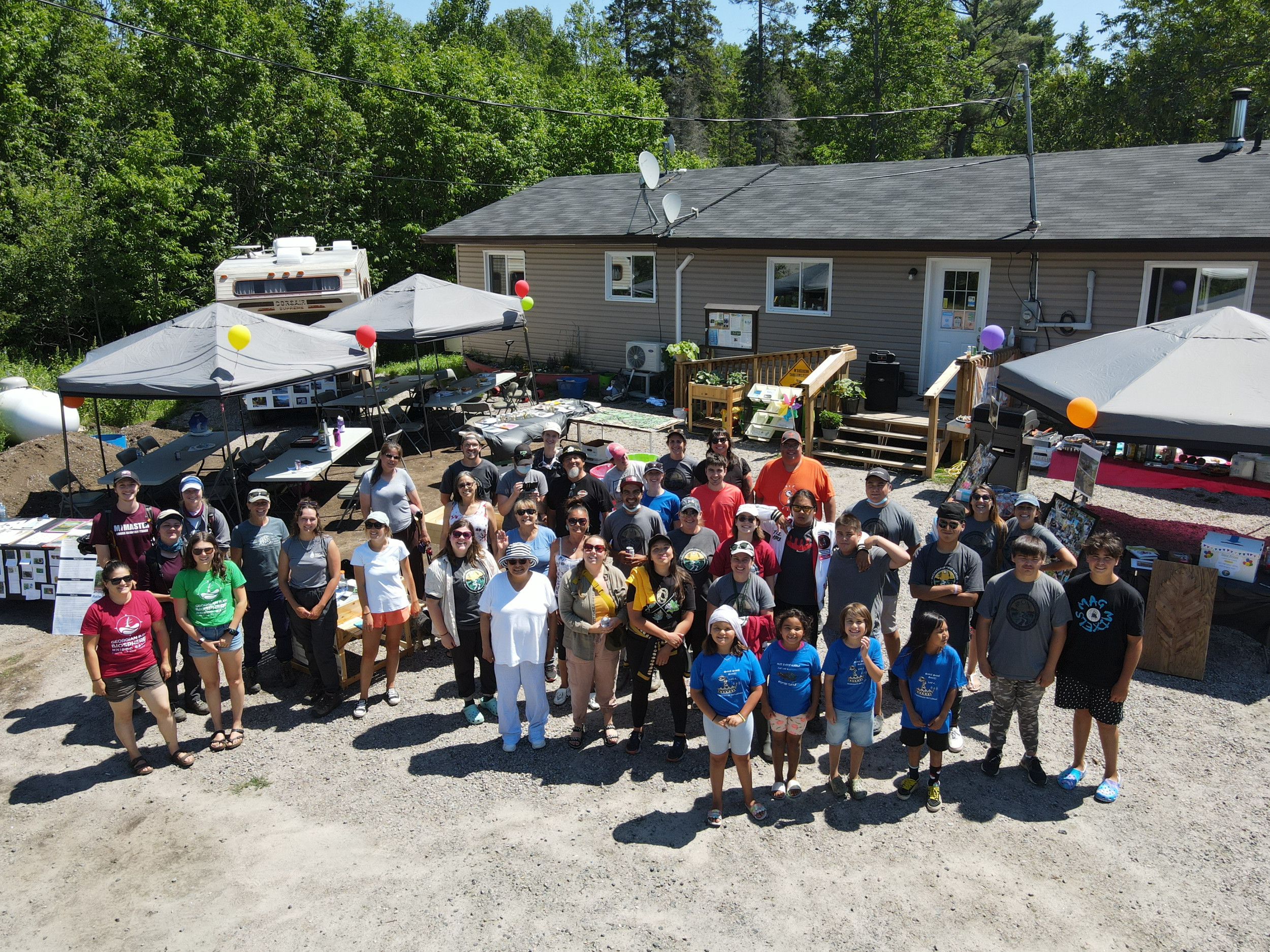
Partner Profile: Magnetawan First Nation
Magnetawan First Nation (MFN) is a biodiversity hot spot consisting of continuous wetlands and rock outcrops that provide ideal habitat for many species at risk. Located on the Magnetawan River in the northern region of the Georgian Bay Mnidoo Gamii Biosphere, the community recognizes the importance of environmental stewardship; a responsibility that is upheld and reflected by members of the MFN Department of Lands, Resources, and the Environment.
Sparked by community observations and concerns over reptile mortality on roads back in 2011, the MFN Department of Lands, Resources, and the Environment, with the help of Dr. Litzgus from Laurentian University, established what has since become a renowned species at risk reptile monitoring and interdisciplinary research program on the coast. The monitoring data and other information gathered across MFN has strengthened the lands department’s ability to advise and guide decisions regarding the protection of the land, mitigation of development, and documenting climate change impacts.
At the heart of the monitoring program is the dedication and hard work of both community members and lands department staff who all work together to embody the Two-Eyed Seeing approach in their work. This is the guiding principle brought forward by Mi’kmaw Elder Albert Marshall of “seeing from one eye with the strengths of Indigenous knowledges and ways of knowing, and from the other eye with the strength of Western knowledges and ways of knowing, and using both these eyes together for the benefit of all.”
MFN’s species at risk program is grounded in land-based community values and complemented by the technical practices and methodology of Western knowledge approaches. The Two-Eyed Seeing approach provides a means of collecting, monitoring, and understanding the wetlands and animal ecology within the Territory in a meaningful way that acknowledges the interconnection of all things.
MFN’s reptile species at risk program has been the gold standard in long-term, community-focused monitoring of animals of cultural importance. Their work has been consistently well-funded by federal and other grants, and was applying a Two-Eyed Seeing approach to knowledge-gathering and building community capacity before that terminology became commonplace. I have been privileged to collaborate with the lands team at MFN for the past 10 years and look forward to continuing to work with them into the future.
Jackie Litzgus, Laurentian University
Community involvement in the program has always been a top priority. The lands department is especially committed to supporting local youth by providing opportunities to learn land-based knowledge from elders while gaining valuable hands-on experience through summer employment and volunteer opportunities in the field.
Over time, the department’s work has expanded from a focus on the reptile species at risk monitoring program to include broader stewardship of the land, the water, and all the animals that call this place home. Partnerships with several organizations, universities, and industry representatives have been an integral part of this expanded focus. Projects have included shoreline cleanups, management of invasive species, including Phragmites australis (or the European common reed), building community gardens, youth-led outreach and education, floodplain mapping, fish habitat assessments, and climate change research. The foundation laid by the reptile species at risk monitoring program will no doubt benefit the community and other communities across the region for the next seven generations.
Follow the MFN lands department on Facebook @magfn_aakii and on Instagram @magfn.aakii.
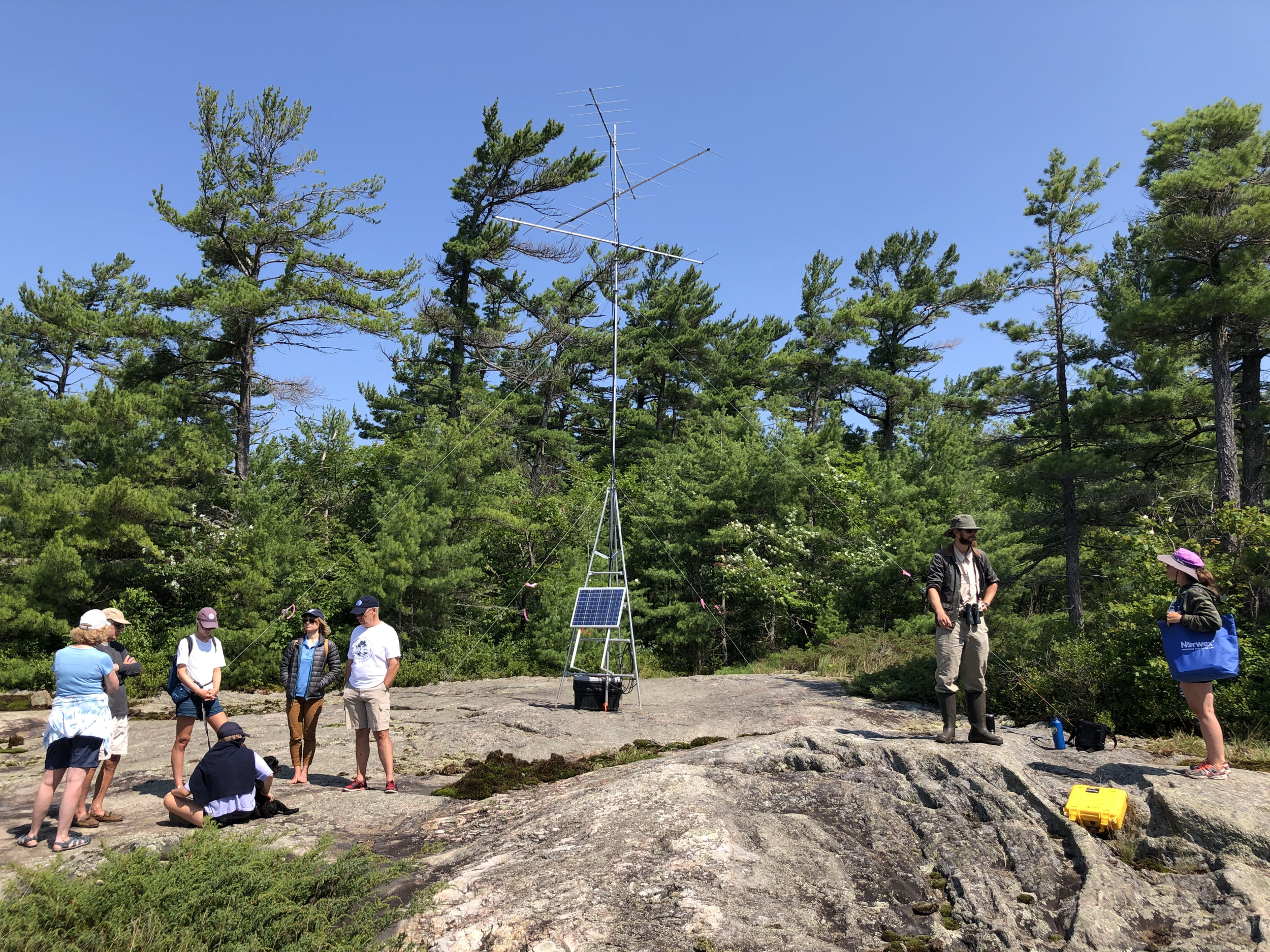
Motus Wildlife Tracking System
Georgian Bay is part of an international network that is helping scientists learn more about migratory species and how to protect them.
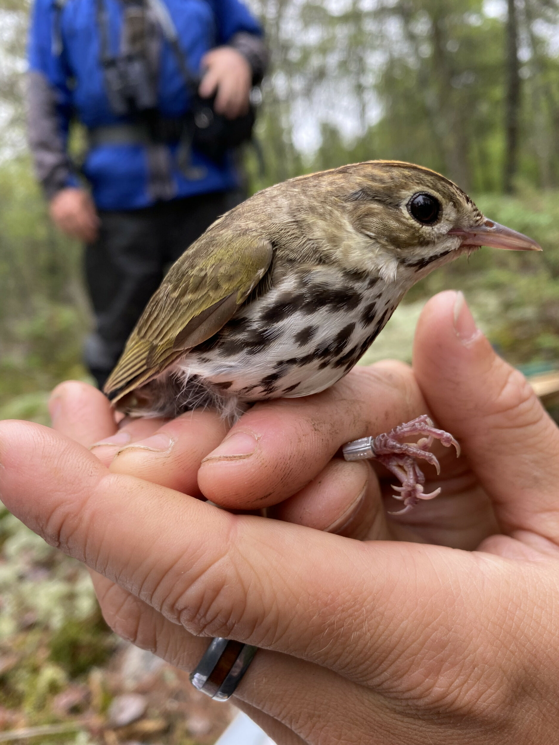
The Motus Wildlife Tracking System records the movements of birds, bats, and even certain migratory insects by using strategically placed towers to pick up signals from tiny radio transmitters attached to the animals. The data is freely accessible to scientists around the world and records everything from transcontinental migratory journeys to localized behaviour patterns. The particular advantage of Motus technology is that once an animal is outfitted with a transmitter, researchers can follow its movements without ever having to recapture or resight it.
In an era of dramatically declining bird populations, this kind of scientific understanding is crucial to identifying causes of mortality and prioritizing conservation actions. Studies done through the Motus system are helping researchers learn more about migratory routes and the connectivity between breeding, migratory, and wintering habitats, understand bird ecology and how environmental factors influence migratory success, and much more. This will help determine which habitats and resources migratory species depend on for every part of their life cycle.
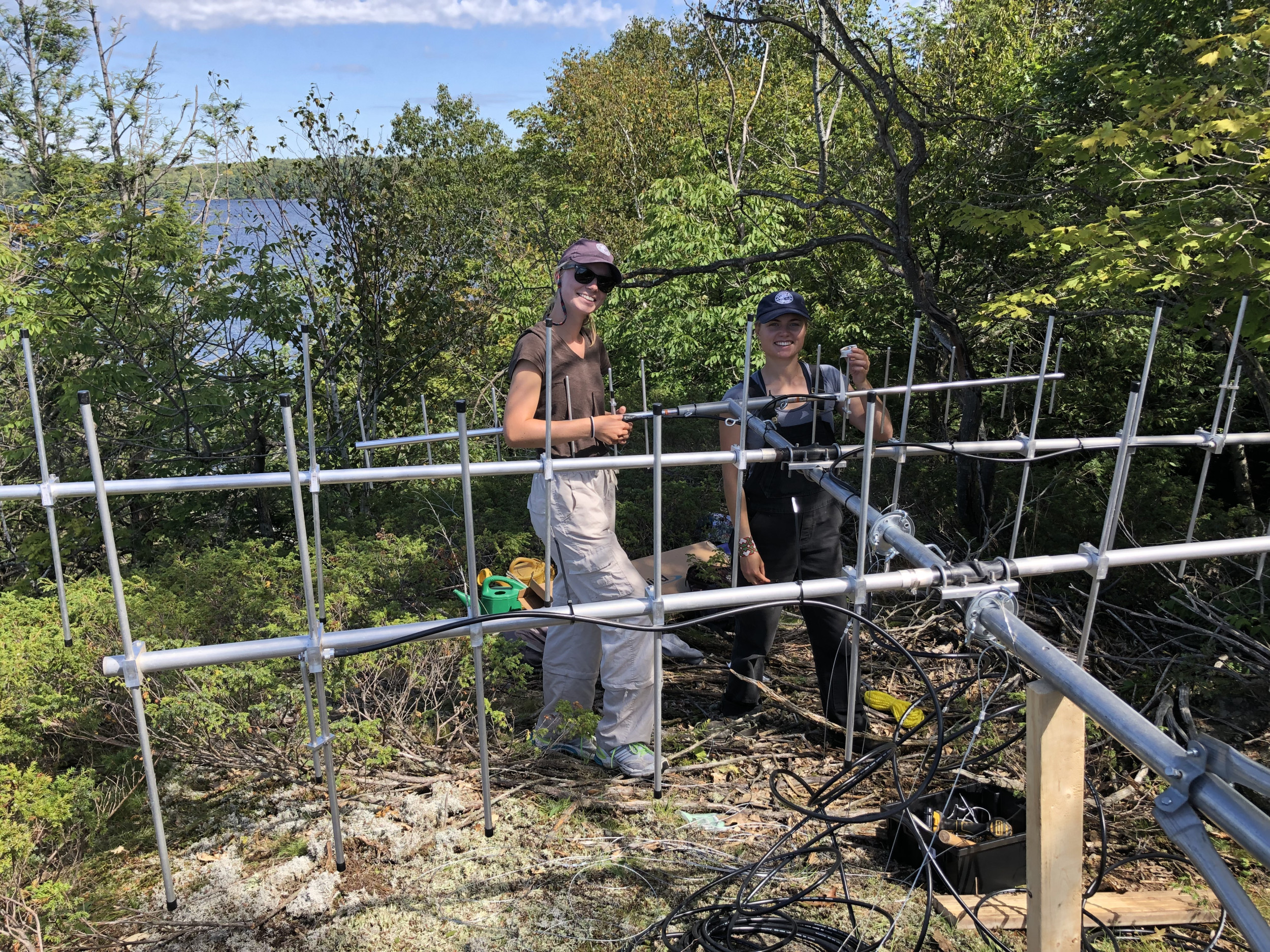
The Motus system relies on a network of receiving stations that are installed and maintained by partner organizations around the world. These stations can pick up signals from any animal travelling within 15 kilometres of the tower. Currently, there are over 1,500 towers spanning 31 countries and tracking nearly 300 different species.
Despite its important bird habitat, Georgian Bay was a blank space on the Motus map until 2017. That changed when the Georgian Bay Land Trust collaborated with Birds Canada to install the first five Motus towers in southeastern Georgian Bay, using Land Trust properties as sites for several of them. In the years since, the network has grown up the coast and inland watershed, now comprising more than 15 towers hosted by several different partner organizations, including the Georgian Bay Mnidoo Gamii Biosphere, Shawanaga First Nation, and Ontario Parks.
These towers now contribute data to dozens of local and international research projects, on species as diverse as the barn swallow, red knot, and eastern red bat. They are also bringing researchers from institutions such as the University of Guelph and Western University to the Georgian Bay area, for studies on eastern whippoorwills, common nighthawks, song sparrows, ovenbirds, and white-throated sparrows.
The more we can understand about how migratory species move, in what habitats they rest, eat, and breed successfully, and how conditions in one location can affect their entire life cycle, the better equipped we will be to support successful conservation efforts. By working collaboratively with Motus, scientists on Georgian Bay and all over the world can advance this knowledge and bring us closer to protecting these species for years to come.
Learn more about Motus.
Partner Profile: McMaster University Ecohydrology Lab
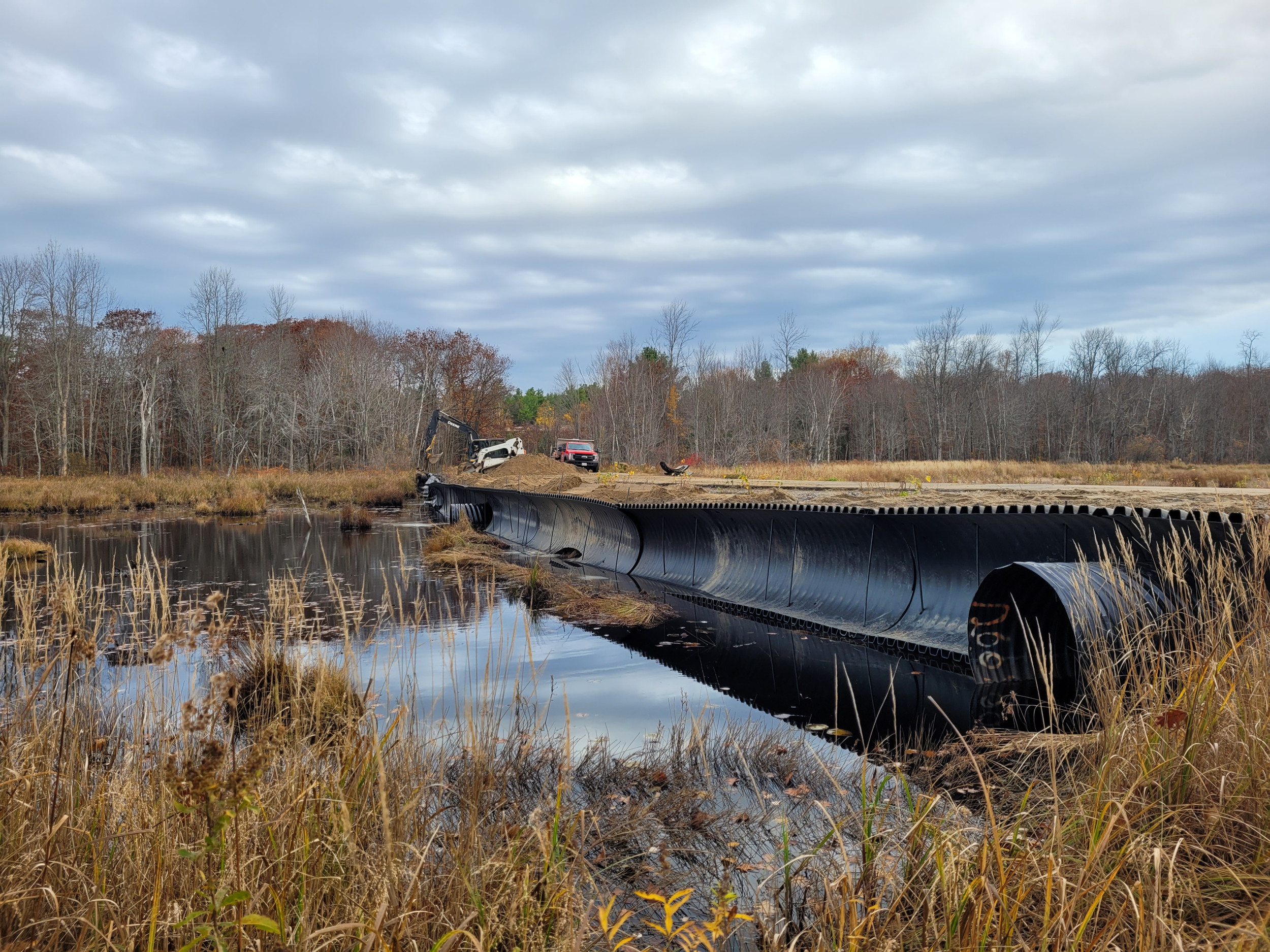
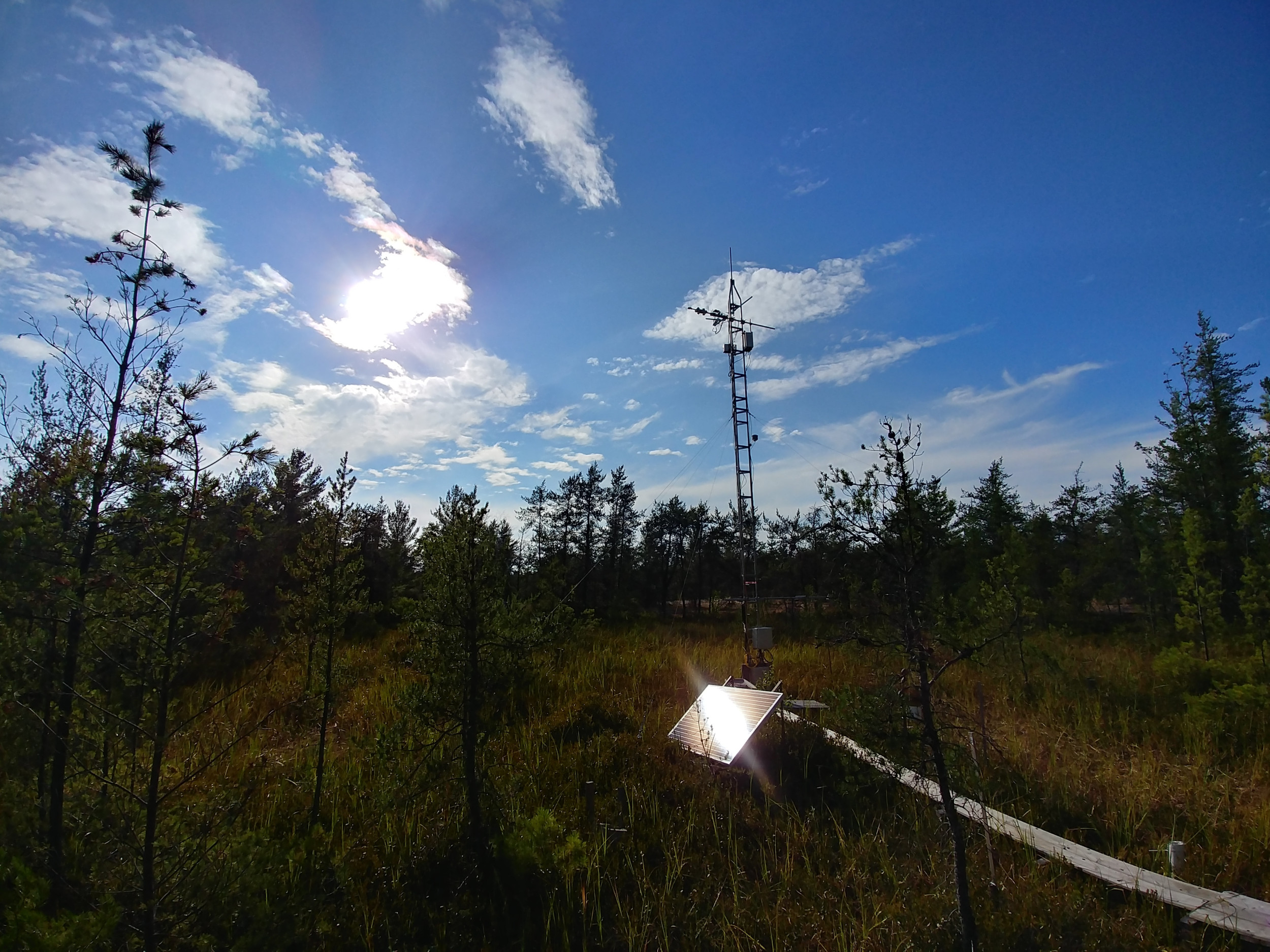
Within the unique patchwork landscape of the Georgian Bay Mnidoo Gamii Biosphere, researchers from the McMaster University Ecohydrology Lab use innovative methods to tackle questions about the impacts of climate change. The Ecohydrology Lab operates NOBEL, the only water observatory in Ontario focusing on water, habitat for at-risk reptiles, and carbon sequestration. The acronym NOBEL stands for Nibi Observatory for Boreal Ecohydrological Landscapes, where nibi is the Anishinaabemowin word for water. NOBEL was established in 2010 and is run in partnership with Magnetawan and Shawanaga First Nations.
The NOBEL observatory consists of more than 10 hydrometeorological towers, as well as over 75 wetlands and small watersheds equipped with various instruments. Here, researchers study factors affecting wetland habitats and their ability to exchange carbon, water, and energy with the atmosphere. The Georgian Bay Mnidoo Gamii Biosphere is within the region of Ontario with the greatest biodiversity of reptiles; unfortunately, this area is also undergoing substantial changes due to drought, fire, and development.
Here, mossy wetlands known as peatlands are critical habitat for at-risk reptiles, including Ontario’s only venomous snake: the threatened Massasauga rattlesnake. These snakes spend about half of their lives overwintering in peatlands and return to the same site each year. They overwinter in mounds of moss called hummocks, above the water table in an area that remains above 0 degrees Celsius, which the researchers call the “resilience zone.”
Unfortunately, climate change makes winters more dangerous for snakes by increasing rainfall, which reduces snow depth and causes flooding. Without a thick insulating snow blanket, hummocks may become too cold. Taller hummocks may provide a larger resilience zone and maintain snake habitat despite climate changes. Since taller hummocks are more likely to burn during a wildfire, researchers hope to understand if there is an ideal hummock height to keep snakes safe during the winter. They are developing methods to predict overwintering habitat locations based on peatland characteristics, like their size or position within the watershed. Peatland areas with trees often have taller hummocks, which may help identify and protect good overwintering sites.
Peatlands help to counteract climate change by taking carbon out of the atmosphere and storing it for long periods of time, because waterlogged moss decomposes very slowly. However, drying peatlands are more vulnerable to fire and more likely to release carbon. NOBEL research has begun to tease out factors that make peatlands more susceptible to climate change impacts. For example, peat depth and microtopography (hummocks and hollows, for example) control water retention of peatland vegetation and affect vulnerability to burning and decomposition.
NOBEL is a collaborative effort between McMaster researchers, First Nations, environmental consultants, and conservation organizations to develop a holistic understanding of wetlands in the Georgian Bay Mnidoo Gamii Biosphere. This network of sites builds capacity for partners to share knowledge crucial to local communities, which are reliant on healthy ecosystems for food, water, and medicines, and to identify and protect vulnerable habitat.
Learn more about the McMaster Ecohydrology Lab.
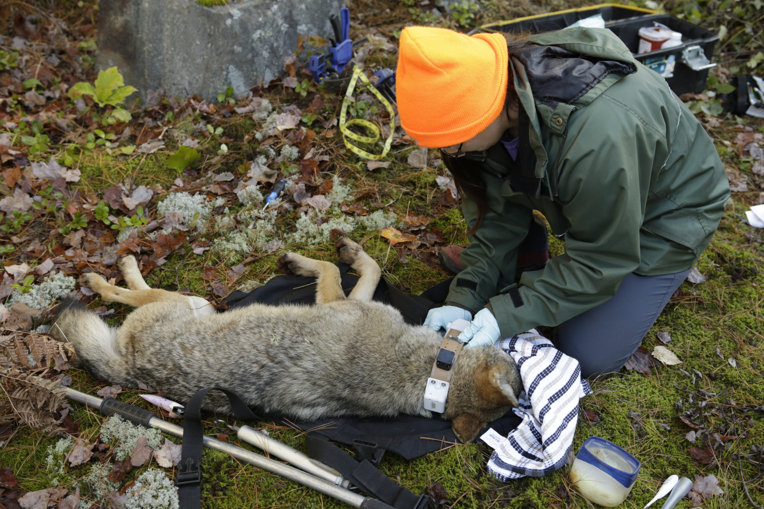
Weaving Ways of Knowing for Ma’iingan (Wolf) Conservation
Human activities in the biosphere region threaten many species, including the eastern wolf (ma’iingan), a species at risk (threatened). Major threats to wolves include habitat loss, hunting, trapping, road mortality, and hybridization with coyotes. Together, Shawanaga First Nation, Magnetawan First Nation, Wiikwemkoong Unceded Territory, the Ministry of Natural Resources and Forestry, the University of Guelph, and a graduate student from Trent University are trying to understand how wolves are dealing with these threats.
The framework of this Indigenous-led, collaborative project follows a “Two-Eyed Seeing” approach, utilizing and braiding together the strengths of both Indigenous knowledge and western science to better understand eastern wolf populations.
To address the questions and concerns raised by community members from Shawanaga First Nation, Magnetawan First Nation, and Wiikwemkoong Unceded Territory regarding the populations of wolves within each of their respective traditional territories, the research team deployed radio collars to track wolf movements. Through the knowledge shared from each community, a total of 14 wolves were collared, with each collar deployed for up to one and a half years, sending GPS data locations every 90 minutes. Collaring allows the research team to understand home range sizes, pack size, diet, genetics, level of hybridization (with coyotes) in the packs, and how the wolves are responding to human-caused changes.
This project supports Indigenous-led, continuous wolf population monitoring to ensure their longevity. It is fully guided and interpreted by each of the First Nation communities as a way to carry on traditional ecological knowledge surrounding wolves for future generations.
Exploring Spaces for Biodiversity Conservation
The Exploring Spaces for Biodiversity Conservation initiative provides an opportunity to extend biodiversity conservation work within the Georgian Bay Mnidoo Gamii Biosphere by assessing how spaces in the region are contributing to the conservation of biodiversity and how they might be expanded in size, or enhanced or restored to support high biodiversity values, such as species diversity or connected habitats.
A protected area (PA) is a clearly defined geographical space that is recognized, dedicated, and managed through legal or other effective means to achieve the long-term conservation of nature with associated ecosystem services and cultural values. An example of this may be a provincial park or some land trust properties.
Other effective area-based conservation measures (OECMs) are lands that may not have the conservation of biodiversity as their primary goal but are managed in a way that results in the effective and enduring conservation of biodiversity. An example of this would be special management zones in county forests, such as Northumberland County Forest.
Adding to the total amount of protected and conserved areas in Canada supports the federal government’s commitment to conserving 25% of land and 25% of inland waters by 2025, and 30% by 2030. Georgian Bay Biosphere staff will be working with partners to:
- evaluate and grow community knowledge of biodiversity;
- build community support for biodiversity conservation through outreach and engagement activities, such as reporting; and
- assess and improve management actions through stewardship and/or restoration of priority areas with key partners.
Learn more at georgianbaybiosphere.com/events

Get Involved
Use the free iNaturalist app to upload your photos of flora and fauna to the “Georgian Bay Biosphere Project” so that all observations in our region can be used for science. With many specialists and amateur naturalists helping to identify species, you will be sure to learn about the incredible biodiversity we have in the Biosphere!
Get started and join over 4,000 volunteer observers who have identified over 5,000 species!
Partner Profile: Georgian Bay Land Trust
Thirty years ago, concerns were growing among residents that Georgian Bay’s extraordinary environment was at risk of permanent damage. Increasing road development and recreational property expansion, coupled with a lack of regional conservation planning, left little protection for the majority of Georgian Bay’s natural areas outside of a few established parks. Communities needed a way to protect the lands they cared about. Inspired by North America’s growing land trust movement, a dedicated group of volunteers along the eastern Georgian Bay coast came together to form the Georgian Bay Land Trust.
A land trust is a charitable organization whose purpose is to hold and conserve land for public benefit. Through donation, purchase, or conservation easement, land trusts protect and steward significant places for present and future generations of people and wildlife.
As of 2023, the Georgian Bay Land Trust protects 72 properties, totalling 3,116 hectares, stretching from Port Severn to the North Channel. Each of these places represents something unique in the ecology of Georgian Bay. They include old-growth forest and provincially significant wetlands, wave-blasted islands and calm vernal pools. Some welcome birdwatchers and picnickers, while others provide overwintering habitat for turtles, gestation sites for Massasauga rattlesnakes, and stopover locations for migrating monarchs. Together they form a network that strengthens our entire ecosystem by maintaining travel corridors and connections for species large and small.
The Land Trust is committed to using the land it stewards well, to give back to the community and advance conservation science. Land Trust properties have welcomed researchers from a number of universities and environmental organizations studying everything from turtle habitat to bat populations. They also host nine Motus wildlife tracking stations, which record signals from radio-tagged birds and contribute data to scientific studies around the world.
The Georgian Bay Land Trust’s vision is of “an eastern Georgian Bay and North Channel whose islands, shores, and inland watersheds are connected and strengthened by a network of protected natural lands and habitats, where native species thrive and people interact with the natural world.”
Thanks to over 1,500 volunteers, donors, partners, and staff who support the work of the Land Trust, this vision is alive and well. Eastern Georgian Bay remains a sanctuary for many animal species whose populations are severely threatened elsewhere, and the network of natural areas is stronger than in many parts of the province and the world. By continuing to prioritize conservation over the next 30 years and beyond, we can ensure that it stays that way.
Learn more about the Georgian Bay Land Trust.
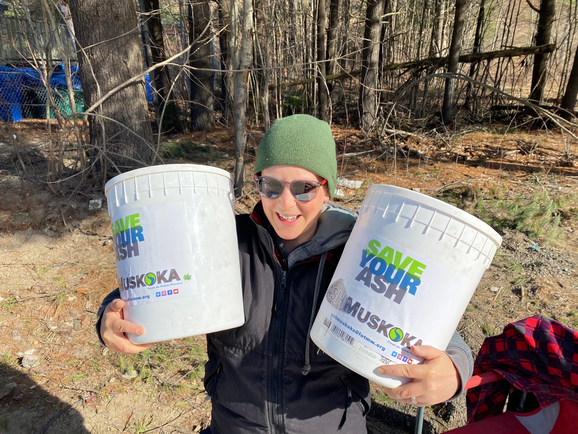
Partner Profile: Friends of the Muskoka Watershed
Calcium is an essential element for all living things. Unfortunately, it has been depleted over decades of acid rain. This is especially true in areas situated on the Canadian Shield, like Parry Sound and Muskoka, where the soil is shallow.
The Friends of the Muskoka Watershed (FOTMW) organization has spent the last few years studying the addition of wood ash to replenish lost calcium in forests, and initial results are positive. They decided that the first step to repairing the forest—and the watershed—was to add calcium-rich wood ash to the forest floor in order to grow healthier trees. Eighty-five percent of the watershed is covered in trees, according to Dr. Norman Yan, a Director with FOTMW.
FOTMW launched the ASHMuskoka project to study the scientific impact of wood ash on forests and to get the community involved. They asked Muskoka’s year-round and seasonal residents to save their household wood ash and deliver it to a central location once per month. Approximately 1,500 people have donated over 27,600 kilograms of ash to the project since June 2019. Volunteers filtered the wood ash and put it into containers for future distribution in forests. Ash samples were also sent to a laboratory for analysis, with results indicating that Muskoka ash is 25 to 30% calcium and contains other key plant nutrients, including potassium, magnesium, and phosphorus.
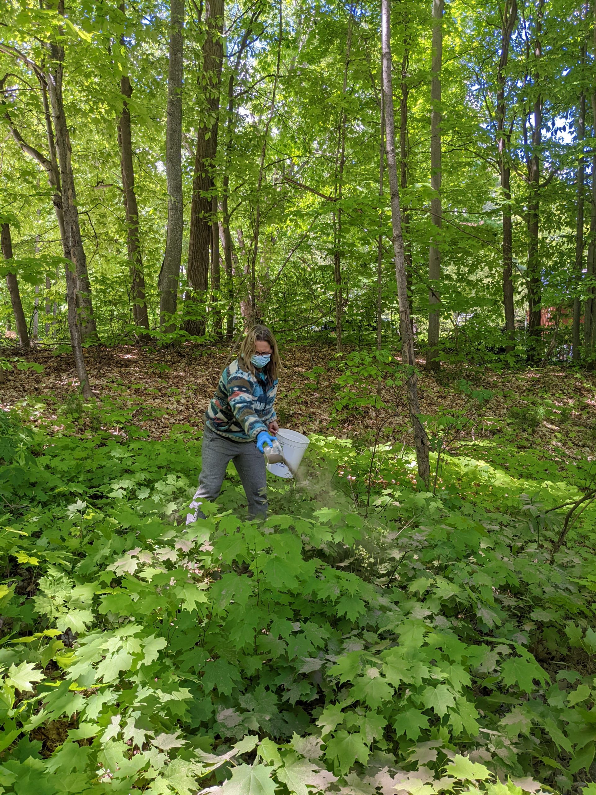
The next step was to spread the ash at test sites across Muskoka. Three maple woodlot owners who operate sugar bushes participated, and an extensive project was done with test sites in the forest at Camp Big Canoe. Graduate students from Trent University ran experiments to measure the impact of the ash.
Dr. Yan explains that they believe they have determined the right amount of ash to “wake up” the forests: “Calcium has been seen in saplings, and we have hints of increased growth within the first year,” he says. “It took years to deplete the calcium in the soil, but early research suggests that one application of ash is all that is needed.”
Early results are showing healthier, more storm-resistant trees. And more studies are underway. Over 10,000 kilograms of ash has been spread since the project started. While research has focused on four main locations and on hardwood trees, there is an interest in understanding the benefits of residential wood ash in different locations and to different tree species. Climate change studies are also being explored. And recently, 80 kits were distributed to participants who wish to experiment with spreading ash on their own trees.
“The citizen science program aims to enrich the understanding of the benefits of wood ash for soil quality, tree health, and tree growth on Muskoka and Parry Sound properties,” says Katie Paroschy, Citizen Science Coordinator for FOTMW. Dr. Yan is pleased that the ASHMuskoka program is getting a positive response from residents. “People can do their part,” he says. “They can do something good.”
Learn more about Friends of the Muskoka Watershed.