Walking for Water
“As a school (Wasauksing Kinomaugewgamik), we like to call ourselves Water Protectors. We try to highlight water protection year-round. It is our way of life. It’s part of who we are as First Nation peoples. No matter where people reside, what we do for a living, our beliefs or age, all of us must relate to water in order to live. Our community wants this kind of life for our children, to be able to openly practise our culture without fear.
In our water ceremony, we always make sure we have four generations of women represented so that these teachings can be continued and passed on. The women carry the copper vessel filled with water from Georgian Bay and sing a water song, and the men carry the Eagle Staff. We are trying to bring more awareness that water is life to us and the importance, the sacredness of water and the life it gives to us and everything in creation—the earth, the animals, the plants, the trees—everything.
Kendan niibiish, kendan bamaadiziwin. Know water, know life”
Ozawaanimkeeqwe, Deina Bomberry

Water Keeping
In Anishinaabe culture, protecting and caring for the water is a role given to women. During a Water Walk, Anishinaabeg women move in ceremony to honour water as a living entity.
Grandmother Josephine-Ba Mandamin was an Elder and Water Keeper from Wikwemikoong Unceded Territory. She began Mother Earth Water Walks when she walked around Lake Superior in 2003. She was joined by others who continued to walk around each of the Great Lakes to pray for the water and raise awareness about the importance of healing and protecting water.
When you walk with the water, you have to listen to what it’s trying to tell you.
Everything we do now will impact our grandchildren for seven generations. If we discontinue our negligence, we can change things around.
Josephine-Ba Mandamin, Biidaasige-Ba
Grandmother Josephine-Ba walked more than 40,000 kilometres to heal the water. Autumn Peltier, Josephine-Ba’s great niece, continues her legacy as part of her water advocacy work.
The Water Walker is medicine roaming the earth, bringing love and prayers.
Isaac Murdoch (Bomgiizhik), artist

Fire (shkode) and water (nibi) balance each other. They need each other in order to be present. Examples of this balance can be seen in the natural world, as water can control where fire may burn, and fire can be used to shape the land. This teaching reflects the balance of roles in the Anishinaabek community: women are seen as caretakers of nibi, and men are seen as caretakers of shkode, with two-spirit people able to fill both of these roles.
Water brings life into the world. Women carry babies in water until they are born. Water is what makes up everything and sustains us. We cannot survive without water. Men are firekeepers. Fire is the entrance to the spirit world and takes lives peacefully out of the world. Smoke from the fire is taken to the spirit world by birds and eagles. There are many teachings about being caretakers and keepers of nibi and shkode.
Gracie Crafts,Niizhogiiziskwe
Water Quality: Total Phosphorus
As the foundation of life in the waters of Georgian Bay, phosphorus is an important nutrient to measure when studying the health of the Bay. Phosphorus is essential for the plants and animals that make up the aquatic food web. Phytoplankton, such as microscopic algae, and aquatic plants require phosphorus to grow, so its quantity in a particular area is a good indicator of an aquatic system’s productivity.

Phosphorus exists in different forms in water. It can be dissolved, bound to particles of soil and other materials, or contained within living or decaying plants and animals. Dissolved phosphorus is easily used by plants and algae and is typically found in low concentrations in unpolluted water bodies. Total phosphorus is a measure of all of these forms of phosphorus combined.
Natural Sources of Phosphorus
- Soil and organic matter
- Spring runoff
- Wildlife wastes
- Atmospheric deposition
Human Sources of Phosphorus
- Wastewater treatment plants
- Detergents and soaps
- Runoff from fertilized lawns
- Runoff from agriculture
- Septic systems
Total phosphorus is also an indirect indicator of recreational water quality. Changes in levels of total phosphorus affect algae growth and water clarity, in turn affecting recreational pursuits, such as swimming, boating, fishing, and simply enjoying the beauty of Georgian Bay. Good water quality and healthy aquatic ecosystems are generally the most important concerns expressed by those living around the Great Lakes.
The Right Balance
The concentration of nutrients in a lake varies depending on how shallow it is, how warm it gets, and how many nutrients it receives from the surrounding watershed. Phosphorus is typically much higher in the spring because of snowmelt from rivers and streams, which carries nutrients into lakes. Some of the phosphorus is consumed during spring and summer, as phytoplankton use it to grow.
You may have heard the terms “nutrient-rich” and “nutrient-poor.” In the context of water quality, these terms refer to the level of nutrients in the water; here we talk specifically about phosphorus. Nutrient-rich lakes are called “eutrophic,” and nutrient-poor lakes are called “oligotrophic.” The best examples of these are Lake Erie and Lake Superior: the former is shallow and warm, while the latter is deep and cold. Lake Erie gets high nutrient inputs from surrounding agriculture and human development; Lake Superior gets much less. There are many other factors at work, including the geology (type of rock and soils), hydrology (water flow), and the natural presence of phosphorus in sediments (internal load).

Having too much phosphorus can lead to excessive algae growth and even algal blooms. These algal blooms make water less attractive for cherished summer activities such as boating and swimming, and if you draw lake water for drinking, it will taste and smell foul. The algal blooms can also produce cyanobacteria, or blue-green algae, which can create toxins dangerous to both wildlife and humans. Oxygen levels in water decline as the algae decompose. Reduced oxygen kills fish, invertebrates, and other aquatic animals.
Not having enough phosphorus, on the other hand, limits productivity, or the amount of aquatic life that can be supported.
Cladophora
Cladophora, a native, hair-like green algae species, has been making headlines in recent years because of its tendency to wash up in large decaying mats on shorelines in some parts of the Great Lakes, especially Lake Erie and Lake Ontario. The algae grow on hard surfaces, like rocks and shells, and when they die off, they break away from these surfaces, wash up on shorelines, and decompose. In places where Cladophora is prolific, these mats can become quite thick and smelly, impeding recreational activities. Fortunately, in Lake Huron, Cladophora biomass approaches nuisance levels only in select areas (Saginaw Bay, for example) that coincide with places where nutrients enter the lake.
Cladophora is not found at visible levels in the nearshore of eastern Georgian Bay, nor has it been reported to foul shorelines in Georgian Bay, except in enclosed harbours.
Todd Howell, Ministry of Environment, Conservation and Parks
To understand water quality in Georgian Bay, scientists look at two different regions of the Bay: the shallow nearshore waters along the coast and the deep offshore waters.
- Nuisance algal blooms: 15 to 20 micrograms/L of phosphorus (potential for harmful or nuisance algal blooms)
- Georgian Bay nearshore: 5 to 15 micrograms/L (nutrient rich, productive ecosystem)
- Georgian Bay offshore: 2 to 5 micrograms/L (nutrient poor and of concern to scientists)

Offshore Waters
In the deep offshore waters of Georgian Bay, phosphorus levels have naturally been low, representing an oligotrophic, or nutrient-poor, state. However, long-term trends show significant total phosphorus declines, with the most dramatic declines observed since the mid- to late-1990s. Offshore total phosphorus concentrations levelled out between 2010 and 2016 at around two micrograms per litre, well below the Great Lakes Water Quality Agreement objective of five micrograms per litre.
For the first time in recorded history, phosphorus concentrations are now as low as those of Lake Superior, and the offshore waters are being described as “ultra-oligotrophic,” meaning total phosphorus levels lower than four micrograms per litre. These results represent an unprecedented low level of phosphorus. This is concerning because just like the shallow nearshore, the offshore open-water system requires enough phosphorus to support a healthy food web and stable fish community. The impacts of this falling productivity are still being studied but are already evident in changes to the lower food web and prey fish populations.
So where did the phosphorus go? The answer is not yet fully understood by scientists. Since the 1970s, efforts to reduce phosphorus pollution to surface water have been successful in reducing the occurrence of nuisance algae in the nearshore, but the invasion and rapid spread of zebra and quagga mussels likely has something to do with it, too. These mussels have an incredible ability to filter nutrients and algae out of the water. Each mussel can filter one litre of water per day, and there are millions of them coating the lake bottom. Their feeding seems to have used up most of the nutrients in the offshore waters of Georgian Bay. However, there are likely more factors at play here, and further research is needed to better understand this phenomenon.
- 1970 to 1980s: Aggressive reduction of phosphorus discharge into Georgian Bay.
- 1990s: Period of relatively stable total phosphorus, but arrival of invasive mussels.
- 2000s: Active filter feeding by mussels, thought to be related to lower total phosphorus levels.
- 2016: Unprecedented low total phosphorus showing fewer nutrients for ecosystem health.
Nearshore Waters
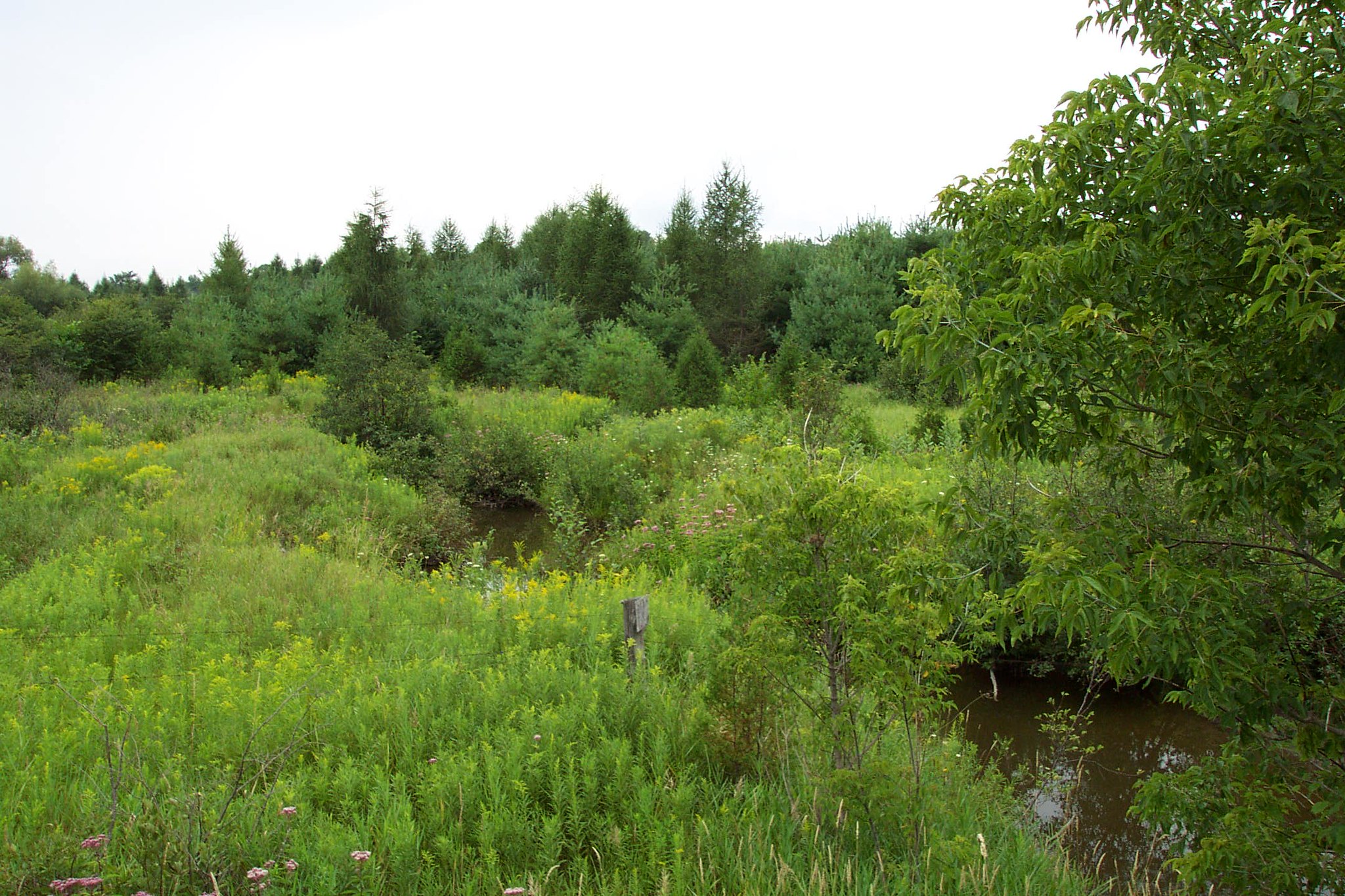
The nearshore waters of eastern Georgian Bay receive nutrients from the surrounding watershed. Nutrients from the landscape are transported into lakes and rivers with runoff, ultimately draining into the Bay and raising phosphorus levels, especially early in the year, after the snow melts. In shallower, protected bays, phosphorus levels can be much higher than in more open areas. This type of nutrient-rich habitat is considered very productive, supporting more species of algae and other aquatic plants, as well as a more diverse fish community.

In contrast to the offshore waters of Georgian Bay, nearshore waters along the coast of eastern Georgian Bay have not experienced the same dramatic loss of nutrients. In fact, some nearshore bays and other areas have the opposite problem: elevated nutrients contributing to nuisance algal conditions. In select nearshore areas, excess nutrient pollution can potentially lead to harmful algal blooms (HABs), and climate change could make the situation worse. Warming water temperatures may be causing faster plankton and algal growth and could lead to more bloom-forming cyanobacteria. More extreme precipitation events could also result in large inputs of nutrient-rich waters from stormwater runoff and soil erosion, potentially fuelling nearshore algal blooms. In addition, lake level changes and high wind and waves can cause erosion and disturb sediments, potentially releasing stored nutrients. The impacts of climate change on nutrient pollution are still being studied.

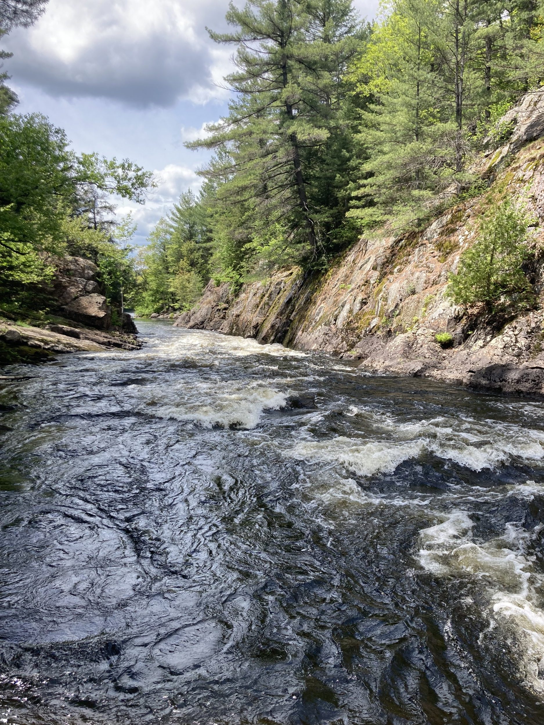
Phosphorus levels in the nearshore of eastern Georgian Bay are generally below the provincial objective of 20 micrograms per litre. However, a few locations have historically seen total phosphorus levels above 20 micrograms per litre, such as the French River and Sturgeon Bay. Unlike the relatively homogenous offshore waters, there is greater variability in nearshore conditions, which are more directly impacted by human activities on the coast and natural influences from adjacent watersheds. Exactly how much phosphorus is in the nearshore waters of eastern Georgian Bay, and therefore how productive these areas are, depends on several factors.
- Proximity to rivers draining water from the phosphorus-rich, forested watersheds of the Canadian Shield. Rivers carry nutrients from their watersheds that ultimately end up in the Bay.
- How much mixing occurs between nearshore and offshore waters. The amount of water exchange between the nearshore and offshore is determined by the connections between Georgian Bay’s small nearshore bays and its open waters. More water exchange, or mixing, means more potential for the dilution of nutrients by the ultra-oligotrophic (nutrient-poor) offshore waters.
- Distance from developed areas of shoreline and intensive agriculture. Rivers, drains, and shorelines also carry pollutants and excess nutrients that run off of city streets and farm fields.
The Offshore to Nearshore Gradient

The result of this dichotomy between the low-nutrient offshore waters and more productive nearshore waters is an offshore-to-nearshore gradient. The differences between the offshore and nearshore do not end with nutrients. Compared to the offshore waters, the nearshore waters:
- are more productive (more nutrients);
- are more coloured (higher amounts of dissolved organic carbon);
- are less clear (lower Secchi depth values);
- are less alkaline (soft water, rather than hard water); and
- have lower levels of calcium.
This gradient means that the offshore and nearshore waters can support different forms and amounts of aquatic life. For example, scientists have found that a certain amount of calcium (roughly 15 milligrams per litre or higher) is needed in the water for successful zebra and quagga mussel growth. With lower calcium levels in the nearshore waters, the growth of these invasive mussels appears to be limited. Higher calcium levels in the offshore waters allow the mussels to proliferate, with effects on water quality, namely declining phosphorus levels. The low-calcium waters entering the nearshore from the watershed have essentially protected these waters from the effects of invasive mussels.

How You Can Help
Reducing phosphorus pollution is still important! An increase in nutrients along the shore will not benefit the offshore deep waters but will instead accumulate, creating nuisance algal blooms—sometimes toxic ones. Here are a few ways you can control your phosphorus output:
- Keep a buffer of native vegetation along shorelines, which reduces nearshore nutrients.
- Avoid the use of detergents and soaps with phosphorus.
- Maintain your septic system properly to avoid leaks and nutrient spills into water.
- Volunteer to monitor water quality near you!
As you read the rest of this report, think about the changes in phytoplankton, zooplankton, prey fish, and top predators. To what degree are these trends related to the loss of nutrients in Georgian Bay? Researchers are working hard to find out!
Get Involved
The Lake Partner Program (LPP) is an Ontario-wide, publicly funded, free program that collects data about phosphorus, water clarity, calcium, and temperature from volunteers. Total-phosphorus and calcium samples are collected once per year, in the spring, and water clarity measurements are taken every two weeks throughout the summer. Find out if there is a volunteer monitoring water quality in your area by visiting ontario.ca/page/map-lake-partner.
Learn more about the LPP and how to volunteer at foca.on.ca/lake-partner-program.
Partner Profile: Severn Sound Environmental Association
Back in the 1970s, Severn Sound looked very different. High levels of nutrients, mainly phosphorus, going into the water from sources like municipal wastewater and stormwater, agricultural operations, and private septic systems, led to visibly degraded water. Low oxygen conditions led to fish kills in various parts of Severn Sound. Beach closures due to bacteria were common, and remnants from industrial operations, like logging, created degraded fish habitat and contaminated sediment.
The health of the Sound was so degraded that in 1987, the International Joint Commission, which advises on cross-border water-related issues in Canada and the U.S., formally listed Severn Sound as one of 43 Areas of Concern (AOC), or toxic hot spots, on the Great Lakes.

Cleaning Up the Sound
Collaboration between federal, provincial, and municipal governments, along with concerned citizens and farmers, led to the development and implementation of the Remedial Action Plan (RAP), designed to tackle the issues plaguing Severn Sound and its watershed. Major actions included:
- upgrading municipal wastewater treatment plants,
- implementing municipal stormwater management,
- restoring stream banks and shorelines,
- assessing fish habitat,
- supporting recovery of trumpeter swans by reducing lead hunting shot in the environment; and
- implementing agricultural best management practices (such as fencing livestock out of streams, planting trees, reducing tillage to minimize soil erosion, and improving manure storage).
Off the List, but Not Off the Hook
Working together, with significant investment and effort, Severn Sound was deemed to be restored and was officially delisted in 2003. At the time, it was only the second AOC to achieve this distinction, with Collingwood Harbour being the first. By that time, the RAP team had morphed into the Severn Sound Environmental Association (SSEA, established in 1997), and there was much celebration. Despite the improvements, several targets related to fish habitat were not fully met.
Our overall effort and success are excellent, and the RAP team should be commended. However … we should proceed as if we were approved and passed but forever on probation, lest we become complacent.
Bob Whittam, former Public Advisory Committee Chair
Twenty years have passed since the 2003 delisting of Severn Sound, and there continue to be many reasons to celebrate: levels of algae-fuelling phosphorus are much lower, and nuisance algae growth has dropped compared to the past. Many tree planting sites are thriving, and beach quality has improved. Municipal wastewater treatment continues to improve and is among the best in the province.
However, there are still stressors, including some that were not considered back in the RAP days. Issues like climate change, invasive species, shifting farming practices, and increasing urban development mean that efforts need to continue to ensure Severn Sound does not slip back to the conditions that made it a toxic hot spot in the first place.
The SSEA continues environmental monitoring and stewardship work as a Joint Municipal Service Board made up of eight municipal partners: Townships of Tiny, Tay, Springwater, Oro-Medonte, Georgian Bay, Severn, and the Towns of Midland and Penetanguishene.
For more information about the SSEA, including results from environmental monitoring programs, visit severnsound.ca.
Bemishkaajig: The Journey We Take
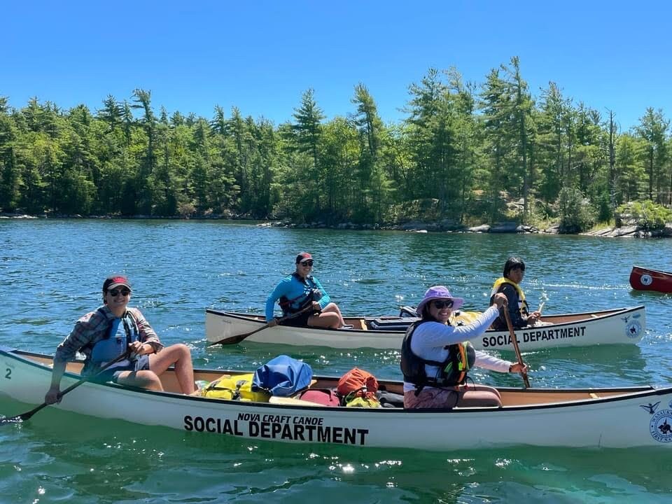
Since time immemorial, and for the past several summers, Indigenous youth have gathered on the shores of Mnidoo-gamii—Georgian Bay—to paddle and to honour and celebrate their home, community, and identity.
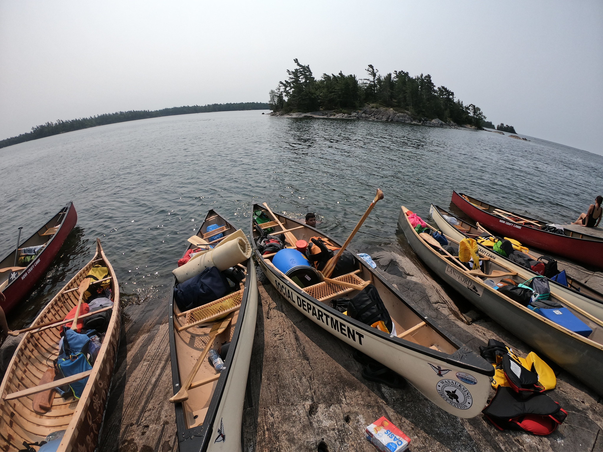
In 2021, a canoe trip starting at Three Mile Lake continued around Wasauksing First Nation for four days. Canoes, gear, and camping equipment lined the shoreline of the lake in preparation for the first day of paddling and the first portage of the trip.
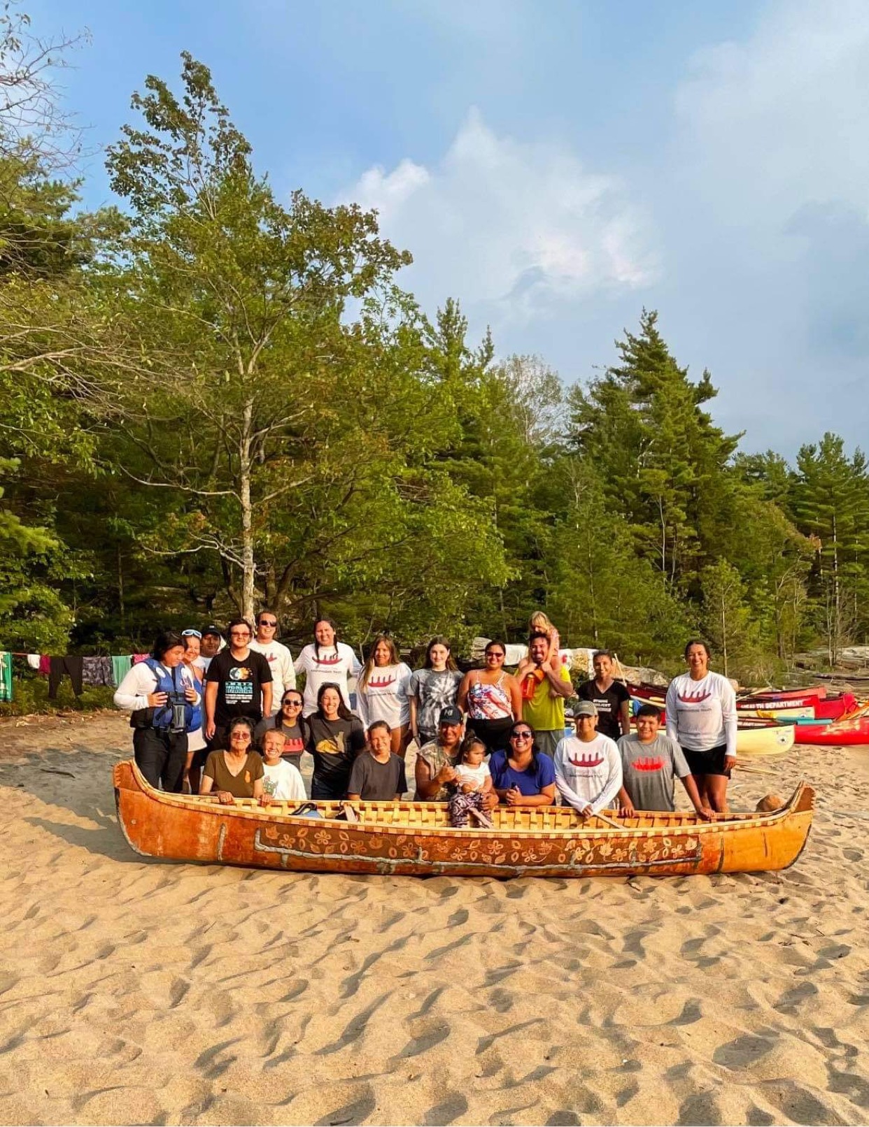
Our name, Bemishkaajig, was bestowed on us as a canoeing group by Waabishki-makwa Dr. Brian McInnes of Wasauksing. Bemishkaajig is a word that was used by Duncan Pegahmagabow-ban that refers to the journey we take as we paddle along the water, but it can also be applied to the way we journey through Bemaadizi [life].
Wasanowndogizikwe, Jordan Tabobondung
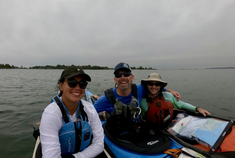
Wasauksing First Nation (WFN) invited local community groups to partner on the project. The Georgian Bay Anishinaabek Youth (GBAY), Parry Sound Friendship Centre, and Rama First Nation jumped at the opportunity to be out on the beautiful waters of Mnidoo-gamii. GBAY members and staff shared the responsibilities of paddling Oshkinigig over the course of Bemishkaajig.
Paddling Oshkinigig was fun and challenging. We quickly learned how to care for Oshkinigig on the water and on the rocks. She turns well, so smooth and effortlessly. The day we paddled through Depot Harbour was very windy, with lots of huge waves crashing into the boat. It was quite challenging.
Taylor Nanowaygahkekwe Judge
WFN provided a dedicated staff member to support the canoe trip by boat. Knowledge holders, elders, and guests were transported to each camping site to visit, share stories, and sing songs with the youth. Some were new to canoeing, so it was important to carry extra safety gear and equipment, in addition to a heavy load of food. Youth could be seen paddling up to the boat to replenish their water or grab a snack.
It was so amazing to be out canoeing around my home. It was an awesome group of people to be out with, and no matter how tired some people got from the long days of paddling, you could always get a smile out of them. It was particularly special to have Oshkinigig out and see her on Georgian Bay.
Dawson Bidwayodaam Bloor
Bemishkaajig offered a tremendous amount of learning for everyone involved. From paddling and logistics to reclaiming cultural understandings and connecting with traditional ways, the partnership enabled this story to be lived and shared.
When we launched, one of the youth said, ‘I wonder when a wiigwaas jiimaan [birch bark canoe] was last paddled here? I bet you my grandparents and their parents paddled a wiigwaas jiimaan.’ The trip was exciting and emotional. For many of us, it felt like a homecoming. We had the opportunity to visit so many places and spaces in our homelands that we would not have had without canoes.
Kyla Zhowshkawabunokwe Judge